Remote Sensing နည်းပညာမိတ်ဆက်
What you will learn
Remote Sensing နည်းပညာ၏အခြေခံသဘောတရားများ
လျှပ်စစ်သံလိုက်ရောင်ခြည်များ၏ ရူပဗေဒ
Remote Sensing နည်းပညာ၏ နယ်ပယ်များ
Remote Sensing ပုံရိပ်များကို ခွဲခြမ်းစိတ်ဖြာ သုံးသပ်ခြင်း
Description
[English Below]
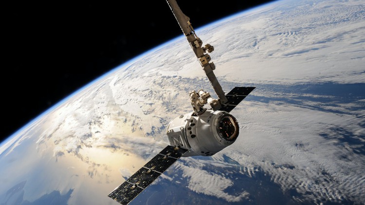
ဤ Course သည် Remote Sensing နည်းပညာ၏ အခြေခံသဘောတရားများကို ကျောင်းသူ၊ ကျောင်းသားများ နားလည်နိုင်စေရန် အေခြခံအုတ်မြစ်ချပေးသော Course တစ်ခု ဖြစ်ပါသည်။ Remote Sensing ၏ အဓိပ္ပာယ်ဖွင့်ဆိုချက်၊ လုပ်ဆောင်ပုံအဆင့်ဆင့်၊ ပါဝင်သော အစိတ်အပိုင်းများနှင့် Passive Versus Active Remote Sensing နှိုင်းယှဥ်ဖော်ပြချက်များကို ဆွေးနွေးသွားရန်ရှိပါသည်။ Remote Sensing တွင် ပထမဆုံးလိုအပ်ချက်မှာ ကိုယ်စိတ်ဝင်စားသော ပစ်မှတ်ဆီသို့ လျှပ်စစ်သံလိုက်ရောင်ခြည်များထုတ်လွှတ်ပေးမည့် စွမ်းအင်ရင်းမြစ်တစ်ခု ဖြစ်ပါသည်။ ထိုစွမ်းအင်သည် သူ၏အရင်းအမြစ်မှ ပစ်မှတ်ဆီသို့သွားရာတွင် လေထုနှင့်ထိတွေ့မှုနှင့် အပြန်အလှန်သက်ရောက်မှုများ ဖြစ်ပါသည်။ ပစ်မှတ်မှ အာရုံခံကိရိယာဆီပြန်လာရာတွင်လည်း လေထုနှင့် အပြန်အလှန်သက်ရောက်မှုများ ဖြစ်နိုင်ပါသေးသည်။ ကျောင်းသူ၊ ကျောင်းသားများသည် ဤ Course တွင် လျှပ်စစ်သံလိုက်ရောင်ခြည်များနှင့် လေထုနှင့် ပစ်မှတ်အမျိုးမျိုးတို့အကြား အပြန်အလှန်သက်ရောက်မှုများကို အသေးစိတ်စူးစမ်းလေ့လာနိုင်ပါလိမ့်မည်။
ထို့အပြင် ကျောင်းသူ၊ ကျောင်းသားများသည် optical remote sensing, thermal infrared remote sensing and microwavev remote sensing အစရှိသော Remote Sensing နည်းပညာ၏ နယ်ပယ်ခွဲများကို လေ့လာရပါလိမ့်မည်။ Remote sensing data များကို ကောင်းကောင်းအသုံးချပြီး အကျိုးရလဒ်ရရှိရန် ထို remote sensing ပုံရိပ်များမှ အချက်အလက်များ ရနိုင်သလောက် ထုတ်ယူနိုင်စွမ်းရှိရပါလိမ့်မည်။ remote sensing ပုံရိပ်များကို ခွဲခြမ်းစိတ်ဖြာလေ့လာခြင်းသည် အသုံးဝင်မည့်အချက်အလက်များထုတ်ယူရန် ၎င်းတို့ကို စိစစ်တိုင်းတာခြင်းပင် ဖြစ်သည်။ နောက်ဆုံးအနေဖြင့် Remote sensing data အမျိုးမျိုးကို ရည်ရွယ်ချက်နှင့် အသုံးချမှုအမျိုးမျိုးအတွက် မည်ကဲ့သို့ ခွဲခြမ်းစိတ်ဖြာလေ့လာရမည်ကို သိရှိရန် ဖြစ်ပါသည်။
ဤ course ကို သန့်မြန်မာ၏ ဖိတ်ခေါ်ချက်ဖြင့် ဦးတင်ကိုဦးမှ ပို့ချပေးထားပါသည်။ ဦးတင်ကိုဦးသည် ထိုင်းနိုင်ငံ၊ Mahidol University တွင် Environment and Resource Studies ဘာသာရပ်အတွက် Ph.D ပြုလုပ်နေသူပညာရှင်တစ်ဦး ဖြစ်ပါသည်။
“This course provides a solid foundation that allows the students to understand the basic principles of remote sensing. We will discuss the definition of remote sensing, concepts of remote sensing workflow and components of remote sensing and the comparison of passive and active remote sensing. The presence of an energy source that illuminates or provides electromagnetic radiation to the target of interest is the first requirement for remote sensing. The energy will come into contact with and interact with the atmosphere it passes through as it travels from its source to the target. As the energy passes from the target to the sensor, a second interaction may occur. Once the energy passes through the atmosphere and reaches the target, it interacts with it based on the properties of both the target and the radiation.
In this course, the students will also explore in detail the interaction of electromagnetic radiation with the atmosphere and a variety of targets. Moreover, the students will also learn about different types of remote sensing including optical remote sensing, thermal infrared remote sensing and microwave remote sensing. On the other hand, in order to take advantage of and make good use of remote sensing data, we must be able to extract meaningful information from the imagery. Interpretation and analysis of remote sensing imagery involve the identification and/or measurement of various targets in an image in order to extract useful information about them. Lastly, we will look at how to interpret and analyze different remote sensing data for different purposes and applications.
This course is prepared by U Tin Ko Oo at the invitation of Thant Myanmar. U Tin Ko Oo is a Ph.D candidate at Mahidol University, Thailand, specializing in Environment and Resource Studies.
Content