A Complete course for beginners an advance Professional Level
⏱️ Length: 4.8 total hours
⭐ 4.79/5 rating
👥 1,809 students
🔄 November 2023 update
Add-On Information:
Note➛ Make sure your 𝐔𝐝𝐞𝐦𝐲 cart has only this course you're going to enroll it now, Remove all other courses from the 𝐔𝐝𝐞𝐦𝐲 cart before Enrolling!
-
Course Caption: A Complete course for beginners an advance Professional Level Length: 4.8 total hours 4.79/5 rating 1,809 students November 2023 update
-
Course Overview
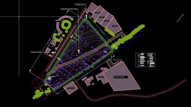
- This comprehensive course is meticulously designed to equip both aspiring and seasoned professionals with the essential skills to master topographic and boundary survey workflows within AutoCAD Civil 3D. It bridges the gap between raw field data and refined, presentable engineering drawings, ensuring participants can confidently handle real-world project demands.
- Embark on a structured learning journey that transcends basic software operation, delving into the practical application of Civil 3D’s powerful survey tools for efficient data processing. The curriculum is crafted to provide a holistic understanding of how survey data integrates into the larger civil engineering design ecosystem, making you a more versatile and valuable asset.
- Discover the intricate process of transforming raw survey measurements into intelligent, dynamic design surfaces and accurate boundary representations. The course emphasizes creating a robust digital model of the terrain, which serves as the fundamental basis for all subsequent civil infrastructure development and land management decisions.
- Gain proficiency in establishing a streamlined “Field-to-Finish” methodology, significantly reducing manual drafting time and minimizing errors inherent in traditional survey data translation. You will learn to automate drawing generation directly from coded field notes, ensuring consistency and adherence to industry standards from the outset.
- This learning experience provides a foundational understanding of geospatial data interpretation and manipulation, essential for any professional involved in land development, infrastructure planning, or geographic information systems. It’s not just about clicks; it’s about understanding the underlying principles and best practices in digital surveying.
- Updated in November 2023, the course content reflects the latest software functionalities and industry best practices, ensuring that your acquired skills are current and highly relevant in today’s fast-evolving technological landscape. This commitment to modern techniques ensures a future-proof skill set for all learners.
- Designed for a diverse audience, from those taking their first steps in Civil 3D to experienced professionals seeking to refine their survey processing techniques, this course offers scalable knowledge. Its modular approach allows learners to consolidate foundational concepts while challenging themselves with advanced productivity strategies.
- Understand the critical role of accurate survey data in project planning, design, and construction, and how Civil 3D facilitates the creation of precision models. This course underscores the importance of data integrity and visual clarity in communicating complex site conditions to project stakeholders.
-
Requirements / Prerequisites
- A fundamental grasp of basic surveying concepts, including coordinate systems, angles, distances, and common survey equipment terminology, will greatly enhance your learning experience. No prior expertise in specific software is required, but a conceptual understanding of field data collection is beneficial.
- Access to AutoCAD Civil 3D software (either a licensed version or a student/trial version) is essential to practice the hands-on exercises and fully engage with the course material. While theoretical understanding is provided, practical application is key to skill development.
- A working knowledge of the Windows operating system and basic computer file management is expected, as navigation within the software and saving project files will be routine activities. Familiarity with standard software interfaces will help you adapt quickly.
- No prior experience with AutoCAD or Civil 3D is strictly necessary, as the course is structured to guide beginners through the interface and core functionalities. However, a general comfort level with CAD environments can be an advantage.
- A stable internet connection is required to access course materials, video lectures, and potentially download exercise files. Consistent access ensures an uninterrupted and efficient learning process.
- A willingness to actively engage with the course material, experiment with the software, and practice the learned techniques is paramount for successful skill acquisition. Dedication to hands-on exercises will solidify your understanding.
-
Skills Covered / Tools Used
- Advanced Survey Data Import & Validation: Beyond mere input, learn sophisticated methods for importing diverse field data formats, validating their integrity, and managing potential inconsistencies to ensure data accuracy from the start.
- Dynamic Digital Terrain Model (DTM) Creation: Master the art of generating intelligent and interactive TIN Surfaces from various data sources, understanding how to refine them for accuracy and use them as the bedrock for all subsequent design elements.
- Automated Drawing Production & Standardization: Develop robust workflows for automatically generating comprehensive survey drawings, including contours, spot elevations, and feature lines, all while adhering to specific office or project drafting standards.
- Precision Boundary Delineation: Acquire the skills to precisely define and represent property boundaries, including complex legal descriptions and easement areas, leveraging Civil 3D’s COGO (Coordinate Geometry) tools for accuracy.
- Comprehensive Survey Data Management: Learn to organize, update, and query extensive survey databases, enabling efficient retrieval and modification of survey information throughout the project lifecycle.
- Error Detection and Correction Techniques: Gain proficiency in identifying and rectifying common survey data errors, such as misclosed traverses or incorrect field codes, directly within the Civil 3D environment to maintain data integrity.
- Visualization and Presentation Skills: Master techniques for creating clear, professional, and visually compelling topographic and boundary maps, using diverse styling and labeling options to effectively communicate design intent.
- Workflow Optimization for Productivity: Implement best practices and utilize advanced software features to streamline your survey processing workflow, significantly cutting down on production time and increasing overall efficiency.
- Data Export and Interoperability: Understand how to prepare and export survey data in various formats for seamless integration with other software applications or for sharing with non-Civil 3D users, ensuring smooth project collaboration.
- Geometric Calculation and Analysis: Utilize Civil 3D’s inherent geometric tools for precise calculations related to areas, distances, bearings, and offsets, critical for accurate boundary and feature layout.
- Customization of Survey Styles: Learn to customize point styles, label styles, and surface styles to meet specific project requirements or company standards, enhancing both the aesthetics and utility of your survey deliverables.
- Tools Used: AutoCAD Civil 3D interface, Toolspace (Prospector, Settings, Survey tabs), contextual ribbons, command line, Property Palette, Styles Manager, Survey Database editor, Points toolbar, Parcel Layout Tools.
-
Benefits / Outcomes
- Enhanced Professional Competency: Emerge with a robust skill set in AutoCAD Civil 3D that is highly sought after in surveying, civil engineering, and land development industries, significantly boosting your employability and career prospects.
- Increased Productivity & Efficiency: Drastically reduce the time spent on manual drafting and data entry by leveraging Civil 3D’s automated “Field to Finish” capabilities, allowing you to complete projects faster and with fewer errors.
- Production of High-Quality Deliverables: Consistently generate accurate, professional, and standardized topographic and boundary survey drawings that meet industry specifications and client expectations, improving your project outputs.
- Strategic Problem-Solving Skills: Develop the ability to approach complex survey data challenges with confidence, applying intelligent software solutions to overcome data inconsistencies and achieve precise results.
- Foundational Expertise for Advanced Design: Establish a strong base for further learning in other Civil 3D modules, such as site grading, road design, and pipeline networks, as accurate survey data is fundamental to all civil design.
- Improved Project Collaboration: Contribute more effectively to multidisciplinary project teams by providing clear, accurate, and easily shareable survey data, enhancing communication and reducing potential rework across different disciplines.
- Career Advancement Opportunities: Position yourself for roles requiring specialized knowledge in digital surveying and geospatial data management, opening doors to more senior positions and leadership opportunities in various firms.
- Cost Reduction Through Accuracy: Minimize costly errors and design revisions that stem from inaccurate survey data, ensuring projects stay on budget and schedule through precise initial data processing.
- Confidence in Data Integrity: Gain the assurance that your survey drawings are not only visually appealing but also geometrically sound and based on thoroughly validated field data, instilling trust in your deliverables.
- Mastery of Industry-Standard Software: Become proficient in a leading software platform for civil engineering and surveying, making you a versatile and adaptable professional in a competitive market.
- Understanding of Regulatory Compliance: Learn how to organize and present survey data in a manner that supports various regulatory submissions and legal requirements for land development and property delineation.
- Personalized Learning Journey: Benefit from a structured course that, despite its brevity, covers a significant breadth of topics, allowing for focused and efficient skill acquisition at your own pace.
-
PROS
- High Student Satisfaction: Boasts an impressive 4.79/5 rating from 1,809 students, indicating a highly positive and effective learning experience for a large user base.
- Up-to-Date Content: The November 2023 update ensures that all course material, techniques, and software functionalities are current and relevant to modern industry practices.
- Comprehensive for Beginners and Advanced Users: Caters to a broad audience, offering fundamental knowledge for novices while providing valuable productivity tips and advanced techniques for experienced professionals.
- Practical, Hands-On Focus: Emphasizes real-world application of AutoCAD Civil 3D tools, enabling learners to immediately apply acquired skills to their projects.
- Concise and Efficient Learning: With a total length of 4.8 hours, it offers a condensed yet thorough learning path, ideal for busy professionals seeking to quickly upskill.
- Boosts Professional Marketability: Acquiring expertise in Civil 3D survey workflows is a significant asset that enhances career opportunities in the civil and surveying sectors.
- Strong Foundational Knowledge: Provides a solid understanding of the entire “Field-to-Finish” workflow, which is critical for anyone involved in processing geospatial data.
-
CONS
- Limited Depth for Complex Scenarios: Given its relatively short duration of 4.8 hours, the course might offer an excellent overview and practical skills but may not delve into the exhaustive complexities or highly niche, advanced troubleshooting for every conceivable survey challenge.
Learning Tracks: English,Teaching & Academics,Engineering
Found It Free? Share It Fast!