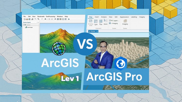
If You Want to Learn Both ArcGIS and ArcGIS Pro to Choose A Suitable Software for Your Particular GIS Task, Then Enroll.
Why take this course?
🚀 Master ArcGIS and ArcGIS Pro: The Ultimate GIS Tool for You! 🌟
Course Overview:
ArcGIS and ArcGIS Pro are indispensable tools in the field of Geographic Information Systems (GIS). Whether you’re a beginner or looking to expand your GIS skillset, this course is designed to cater to all levels. With MD. Shahriar Alam as your expert guide, you’ll navigate through both software platforms, learning which one suits your specific needs and how to leverage their full potential.
Why Enroll in This Course? 🤔
For the Learner Who…
- 📚 Wants to Learn Both ArcGIS and ArcGIS Pro: Gain a comprehensive understanding of both platforms.
- 💻 Doesn’t Have ArcGIS Pro Software: Don’t let lack of resources hold you back; learn virtually.
- 🧬 Has No Prior GIS Knowledge: Start from scratch and build your GIS foundation the right way.
- 🚀 Wants to Work Smartly with Dynamic Tools: Discover efficient ways to handle your GIS tasks.
- ⚫️ Is Afraid of Programming: Overcome your fear with easy-to-follow, practical programming guidance.
- 💎 Seeks a Cost-Effective Solution: Benefit from an affordable course packed with detailed materials and resources.
- 🎓 Desires Engaging Lectures: Enjoy magical tricks descriptions on each interface with cool, enjoyable lectures.
- 📖 Wants to Learn Step by Step: Understand the ‘how’ and ‘why’ behind each process with practical doing videos.
Course Highlights:
What You Will Learn…
- 🛠️ All Tools of ArcGIS and ArcGIS Pro: Tailored for real-world GIS work and activities.
- 📅 How to Get ArcGIS Pro Software Free: Take advantage of a 23-day free trial, plus license assignment and installation guidance.
- 🌱 Zero to Hero in GIS: Master ArcMap, ArcGlobe, ArcScene, and ArcGIS Pro from the basics to advanced techniques.
- ✨ Choosing the Right Software for Your Tasks: Learn which tool is best suited for your specific GIS needs.
- 🔧 Programming Made Easy: Receive a magic base formula to start writing any programming language with confidence.
- 💰 Cost-Effective Education: Access over 40 lectures, including 2 articles and a final assignment, all at an affordable price.
- 🎬 Dynamic Tools and Magic Tricks: Get hands-on with enjoyable tools and tips for ArcMap, ArcGlobe, ArcScene, and ArcGIS Pro.
- 📚 Step by Step Learning: Each lecture is crafted to guide you through the learning process, emphasizing practical application and learning by doing and playing.
Course Features:
- 40+ Lectures: Extensive video content covering all aspects of ArcGIS and ArcGIS Pro.
- 2 Articles: In-depth articles to complement the lecture material.
- 1 Final Assignment: Solidify your knowledge with a capstone project.
- Engaging and Interactive Content: Learn with a combination of theoretical knowledge and practical exercises.
- Magical Tips and Tricks: Discover shortcuts, powerful features, and efficient methods to enhance your GIS workflow.
🎓 Enroll Now to unlock your potential in GIS and become proficient with ArcGIS and ArcGIS Pro! With MD. Shahriar Alam’s expertise, you’re set for success. Let’s embark on this transformative journey together! 🌐✨
Alright folks, let’s talk GIS. I’ve been kicking around the geospatial world for a good while now, and I’ve seen my fair share of courses promising the moon. So, when I stumbled across the ‘GIS Mega Course – ArcGIS vs ArcGIS Pro, Python, QGIS & RS’, I was naturally curious, and frankly, a little skeptical. Could one course really deliver on such a broad promise? After diving in, I’ve got some thoughts, and I’m not pulling any punches.
Overview
This course aims to be your one-stop shop for pretty much everything GIS, from the classic ArcGIS Desktop suite all the way to its shiny successor, ArcGIS Pro, and even ventures into the open-source darling, QGIS. What caught my eye was the promise of not just learning these tools in isolation, but understanding their nuances, particularly the transition from ArcMap to ArcGIS Pro. They also weave in Remote Sensing (RS) and the increasingly critical Python scripting. The idea is to give you a holistic view of the GIS workflow, equipping you to tackle diverse projects. It’s pitched as a comprehensive learning experience designed to build job-ready skills by covering the entire pipeline from data creation to analysis and visualization.
Prerequisites
Honestly, you don’t need to be a GIS guru to jump in. They do a solid job of taking you from beginner to advanced. However, a general comfort with computers and a willingness to learn are essential. If you’ve got some basic data management concepts under your belt, that’s a bonus, but not a deal-breaker. They do expect you to be able to follow along with the software demonstrations.
Skills & Tools
This is where the course really shines, or at least tries to. You’re looking at mastering ArcGIS Desktop (ArcMap, ArcCatalog, ArcScene, ArcGlobe), getting a deep dive into ArcGIS Pro, and gaining proficiency in QGIS. The inclusion of Python is a massive plus, opening doors for automation and more complex analysis. They cover data management with shapefiles and geodatabases, digitization, and spatial editing in both 2D and 3D. The Remote Sensing component adds another layer of valuable skills for analyzing satellite and aerial imagery, crucial for many modern GIS applications. Expect to get hands-on with industry-standard tools.
Career Benefits & Job Roles
If you’re looking to boost your career growth in the geospatial field, this course could be a serious contender. The breadth of tools covered makes you a versatile candidate. You’ll be better positioned for roles like GIS Analyst, GIS Technician, Remote Sensing Specialist, Geomatics Engineer, or even roles that require a strong understanding of spatial data for business intelligence. The emphasis on understanding the differences between ArcGIS and ArcGIS Pro is particularly valuable, as many organizations are still in transition, and knowing both is a significant advantage. It’s also geared towards building practical experience that can translate well into certification prep.
Pros
- Comprehensive Coverage: This is undoubtedly the biggest strength. Covering ArcGIS Desktop, ArcGIS Pro, QGIS, Python, and RS in one package is ambitious but incredibly valuable for building a well-rounded GIS skillset.
- ArcGIS Pro Transition Focus: For anyone currently using ArcMap or looking to get into newer projects, understanding the shift to ArcGIS Pro is crucial. The course tackles this head-on, which is a major selling point.
- Hands-on Learning with Real-World Projects: The course emphasizes practical application. You’re not just watching lectures; you’re expected to engage with the software, build datasets, and work through realistic GIS scenarios, which is essential for developing true job-ready skills.
- Python Integration: The inclusion of Python scripting is a game-changer. It elevates the course beyond basic GIS software operation and prepares you for more advanced, automated workflows.
Cons
My main gripe, and it’s an honest one, is that with such a vast scope, the depth of any single topic can sometimes feel a bit stretched. While you get a solid introduction and functional understanding of each tool and concept, don’t expect to emerge as a seasoned expert in *every single aspect* of, say, advanced geostatistics or complex Python libraries immediately after completing the course. It’s a marathon, not a sprint, and you might need to supplement with more specialized learning later on for niche areas. Think of it as building a very strong foundation with a lot of different building blocks.