Create clickable maps of 230+ countries and continents without coding
What you will learn
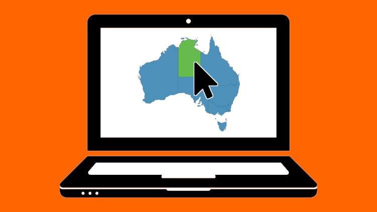
You will be able to generate interactive maps of the world, countries and continents
You will be able to create interactive maps without coding
You will be able to embed clickable maps in your site
You will be able to create clickable maps with ease
Why take this course?
**Headline:** Dive into the World of Interactive Maps – Craft Engaging Visual Experiences for Your Audience!
**Description:**
Unlock the potential of interactive maps and transform the way you present geographical data or engage your audience. **Interactive Maps: Create Clickable World Maps Without Coding** is your gateway to a visually captivating, user-friendly digital landscape. 🌍🗺️
**What You’ll Learn:**
– **Understanding Interactive Maps:** Discover the essence of clickable maps and their versatile applications in various fields such as business, education, and data visualization.
– **Vectors of Success:** Learn where to source high-quality vector files for your maps, ensuring precision and scalability across devices.
**Key Course Highlights:**
🔹 **The Art of Interactive Maps:** Explore the two primary methods to create interactive maps, complete with a detailed discussion on their strengths and limitations.
– **Method 1:** A hands-on approach utilizing popular software.
– **Method 2:** An intuitive solution for non-programmers.
🔹 **Hands-On Projects:** Roll up your sleeves as you get practical by creating clickable maps of:
– The World 🌎
– Italy 🇮🇹
– The United States 🇺🇸
– Kenya 🇰🇪
🔹 **Mastering WorldMapHD:** Gain an in-depth understanding of our premium tool, WorldMapHD, which empowers you to create interactive maps effortlessly, with zero coding required.
**Course Structure:**
– **What is a Clickable Interactive Map?** Learn the fundamentals and how they can captivate your audience or clients.
– **Where Should You Use Interactive Maps?** Uncover the potential of interactive maps in various sectors and industries.
– **Where to Find Vector Files for Maps:** Discover the best sources for high-resolution, editable vector files.
– **Creating Interactive Maps with WorldMapHD:** A comprehensive walkthrough of our user-friendly platform, tailored to both beginners and seasoned users.
– **Real-World Application:** Put your new skills into practice by creating interactive maps tailored to specific regions or countries of your choice.
By the end of this course, you’ll have a robust skill set to design, implement, and publish your own interactive maps for a wide range of applications. Whether you’re in marketing, education, research, or any field that benefits from geographical data visualization, this course will equip you with the knowledge and tools to make an impact.
Join us at **WorldMapHD .com** and embark on your journey to becoming an interactive map-making expert today! 🚀🎉
—