Zero to Hero in ArcGIS Pro – Your Step-by-Step Guide to Master Smart GIS Work!
What you will learn
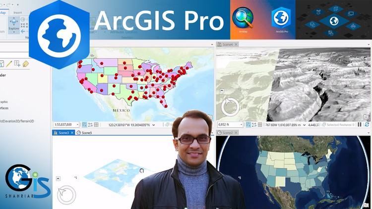
ArcMap vs ArcGIS Pro User Interface
Global Scene, Local Scene and Catalog Project
Create New Project
Create Shapefile
Edit Shapefile Both in 2D & 3D
Difference Between ArcMap Editor and ArcGIS Pro Edit
Symbology Options of ArcGIS Pro
Web GIS Project by Using ArcGIS Pro
Map Publish in ArcGIS Online
Magical Tips to Start Writing Any Code Languages Easily
ArcGIS 2D and 3D Symbology
Case Study 1: Identify The Summation of Male and Female Population in Each State of USA
Case Study 2: Identify Latitude/Longitude Value of Each Point Feature and Create a New Field to Input These Values
Case Study 3: Calculate Area of Each Polygon Feature
Case Study 4: Calculate Total Number of Vertices of Each Polygon Feature
What is Web GIS?
Add KML, Shapefile, Raster Data and Georeferenced Image
How to Copy Attribute Rows to Excel File with Field Name as Column Heading
How to Create Your Organization Web Page in ArcGIS Hosting
Dot Density
Heat Map
Content Tools and Properties
Layer Pop-Up Menu
Editing Tools of ArcGIS Pro
Histogram
How to Create and Modify Feature
Right Angle Line Tool
Circle Drawing
Rectangle Drawing
Trace Tool
Rotate Feature
Add or Delete Vertices
Merge
Split Tool
Snapping Tool
Non-Editable Layer
Different Types of Symbology of Different types of Feature
Single Symbol, Unique Symbol, Graduated Color, Graduated Symbol, Unclassed Color and Proportional Symbol
Vary Symbology by Attribute
Layer Transparency Based on Attribute
Color Change Based on Attribute
What is Specific Field for Symbology
Differences Between Graduated Color and Unclassed Color Symbol
Dynamic Rotation of Proportional Symbol
Which Symbology We should Select for Our GIS Project
Effects of Symbology Including Buffer Effect, Arrow Effect, Wave effect and Dash Effect
Use of Symbology in a Scene Project
Offset Distance
Equal Interval Method
Natural Breaks (Jenks) Method
Defined Interval Method
Standard Deviation Method
Label Properties of ArcGIS Pro
Label Visibility Range
Difference Between ArcMap and ArcGIS Pro to Use Label
Label Placement
Position Offset
Halo for Label
Curved Label
View Unplaced Label
Code Expression Techniques of Calculate Field Window
Geometry Properties
Coordinate System for Calculate Geometry
Shortcut Way to Add Nice Label for Point Feature
Callout Label
Label Rotation
Attribute Table
Add Field
Calculate Field
Calculate Geometry
Pop Up Menu of Attribute Table
Hide Field
Field Alias
Edit Feature
Layer Properties
ArcGIS Pro License Assign
File Extensions and Folders of ArcGIS Pro Project
Types of ArcGIS Pro Project
Map Project
Basemap Facilities in ArcGIS Pro
Potentialities of ArcGIS Pro Interface
How to Create a Combined Project including Map, Global Scene and Local Scene
Insert Tab
Difference Between Menu and Tab
Tools of ArcGIS Pro
Grid
X,Y Coordinate and Unit
Navigator Tool for 3D Map
Layer Placement in 3D Basemap
Difference between ArcMap Table of Content and ArcGIS Pro Content
How to Activate Identify and Selection Tool
Export Features
Layer Properties
Value of Web GIS in Job Sector
ArcGIS Online Account
Add-On Information:
Note➛ Make sure your 𝐔𝐝𝐞𝐦𝐲 cart has only this course you're going to enroll it now, Remove all other courses from the 𝐔𝐝𝐞𝐦𝐲 cart before Enrolling!
- Unlock the power of geospatial analysis with a comprehensive journey from GIS novice to ArcGIS Pro expert.
- Navigate the intuitive and modern ArcGIS Pro interface with confidence, understanding its advantages over legacy systems.
- Master the art of project creation, data management, and spatial data manipulation using both 2D and 3D environments.
- Develop a keen eye for visual storytelling by exploring a rich array of symbology options to represent your data effectively.
- Transform your static maps into dynamic, interactive experiences through the creation and publishing of Web GIS projects.
- Gain practical, hands-on experience through a series of real-world case studies designed to solidify your understanding of core GIS concepts.
- Discover efficient workflows for data transformation, attribute management, and spatial calculations to streamline your analysis.
- Learn to leverage the capabilities of ArcGIS Online for collaboration, sharing, and deploying your GIS solutions.
- Acquire foundational skills that open doors to diverse career opportunities in GIS and related fields.
- Understand the underlying principles of geospatial data and how to work with various data formats and projections.
- Develop problem-solving skills applicable to a wide range of industries, from environmental science to urban planning.
- Gain proficiency in creating compelling data visualizations that communicate complex information clearly and effectively.
- Explore the fundamentals of 3D GIS and its applications in visualizing and analyzing the world around us.
- Build a strong foundation for advanced GIS techniques and future learning in the field of spatial technology.
- PROS:
- Provides a comprehensive curriculum covering a broad spectrum of ArcGIS Pro functionalities.
- Emphasizes practical application through case studies and real-world scenarios.
- Equips learners with highly marketable skills in the growing field of GIS and Web GIS.
- Offers a clear progression from foundational concepts to more advanced techniques.
- CONS:
- May require significant time commitment to fully grasp and apply all learned concepts.
English
language