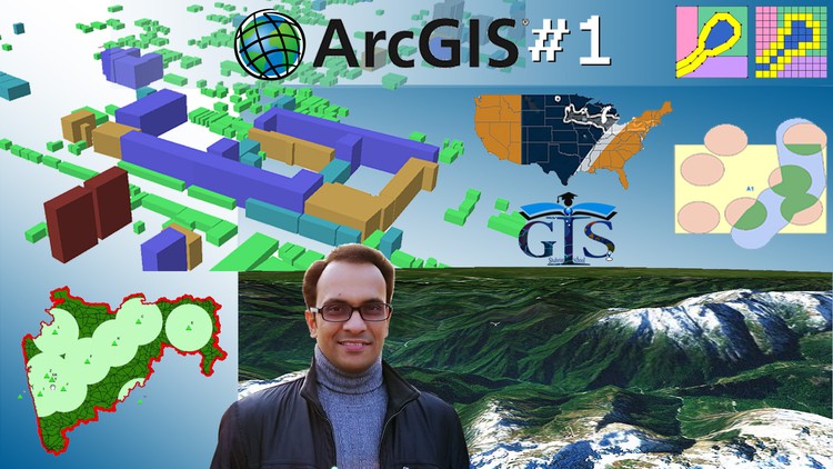
Make yourself Zero to HERO in GIS and ArcGIS with ArcMap, ArcGlobe, ArcCatalog, ArcScene and Web GIS Basic
Why take this course?
🚀 Master ArcGIS from Scratch to Confidence!🌱
Course Headline:
ArcGIS Level 1: Unlock the Power of GIS & Become a Pro with ArcMap, ArcGlobe, ArcCatalog, and ArcScene
Your Journey to GIS Mastery Begins Here!
Are you on the edge of the geospatial world, eager to dive into the realm of Geographic Information Systems (GIS) but feeling overwhelmed by the plethora of information out there? 🌍🔍
Why Choose This Course?
- Comprehensive Learning Materials: We’ve compiled everything you need to master ArcGIS in one place.
- Learn from Scratch to Expert: Transform your skills from zero to hero with our structured, step-by-step approach.
- Affordable and Detailed: With 60 lectures, 33 downloadable resources, and a wealth of interactive content, this course is a bargain for the depth of knowledge you’ll gain.
What You Will Learn:
- Mastering ArcMap: Get hands-on with the fundamental tool for map creation and analysis.
- Exploring ArcGlobe, ArcCatalog, and ArcScene: Discover how to visualize data in a global and local context.
- Web GIS Basics: Gain a foothold in the world of web mapping and GIS servers.
- Advanced GIS Insights: Learn about advanced functionalities that will set you up for more complex projects.
Course Features:
- 13 Sections: Each with its own set of lectures, covering a wide range of topics from the basics to advanced features.
- Interactive Quizzes: Reinforce your learning with 13 quiz tests throughout the course.
- Real-World Practice: Engage in hands-on activities with practical doing video tutorials.
- Magical ArcGIS Tricks: Uncover tips and tricks that will save you time and enhance your GIS workflow.
- Step-by-Step Processes:</straight to the point, easy-to-follow guides for all tasks and tools in ArcGIS.
Who Is This Course For?
- Beginners who are new to GIS and ArcGIS.
- Anyone looking to learn ArcGIS with a focus on ArcMap, ArcGlobe, ArcCatalog, and ArcScene.
- Professionals seeking to enhance their GIS skills.
- Students in geography, urban planning, environmental science, and related fields.
- Enthusiasts who want to explore the world of Web GIS and Advanced GIS.
Your Learning Path:
- Introduction to GIS and ArcGIS: Understand the foundation of GIS and what ArcGIS brings to the table.
- Getting Started with ArcMap: Learn the essentials of creating, analyzing, and displaying geographic data.
- ArcGlobe Exploration: Visualize global datasets with Earth’s three-dimensional surface.
- Data Management with ArcCatalog: Efficiently manage spatial data with ArcGIS.
- Interactive 3D Visualization with ArcScene: Bring your GIS data to life in three dimensions.
- Introduction to Web GIS: Understand the basics of sharing and utilizing GIS resources online.
- Advanced Topics: Delve into more complex spatial analysis and scripting tools.
- Capstone Project: Apply what you’ve learned in a practical, real-world project that will showcase your new skills! 🛠️🌟
Enroll Now and Start Your GIS Adventure Today! 🎉
With this comprehensive course, you’ll not only learn the intricacies of ArcGIS but also gain confidence to tackle any GIS project that comes your way. Don’t miss out on this opportunity to become a GIS hero. Enroll now and join a community of GIS professionals who are making a difference every day! 🌍💼
Bonus:
- Community Access: Join a community of like-minded learners and professionals. Share insights, ask questions, and network.
- Continuous Updates: Benefit from ongoing updates to the course materials as ArcGIS evolves.
- Career Guidance: Receive career tips and guidance to help you leverage your new skills in the job market.
Embark on your GIS journey today and become the expert you’re meant to be! 🚀📊
- Embark on Your GIS Journey: Gain a comprehensive understanding of Geographic Information Systems, its fundamental principles, core components, and diverse real-world applications across various industries, setting a strong foundation for your geospatial career.
- Navigate the ArcMap Environment: Master the primary interface for data visualization and analysis, learning to effectively add, symbolize, and query spatial data layers to extract meaningful insights and represent geographic phenomena.
- Craft Impactful Maps: Develop essential cartographic skills to create professional-quality maps, including designing effective layouts, incorporating legends, scale bars, north arrows, and dynamic text elements for clear and compelling communication of spatial information.
- Perform Essential Geoprocessing: Execute foundational geoprocessing tools to manipulate, analyze, and transform geospatial data, such as clipping, merging, and buffering, laying the groundwork for more advanced spatial analysis tasks.
- Efficiently Manage Data with ArcCatalog: Learn best practices for organizing, indexing, and managing your spatial assets using ArcCatalog, including connecting to various data sources, working with different geodatabase types (file, personal), and understanding metadata.
- Explore the World in 3D with ArcGlobe: Discover how to visualize and interact with global-scale geospatial data in a three-dimensional environment, understanding how to drape imagery, analyze elevation surfaces, and appreciate the Earth’s curvature.
- Deep Dive into Local 3D Scenes with ArcScene: Acquire the ability to create and manipulate localized 3D scenes, integrating elevation data with features like buildings, trees, and utilities for detailed urban or environmental modeling and visualization.
- Understand Coordinate Systems and Projections: Grasp the critical concepts of spatial referencing, geographic and projected coordinate systems, and map projections, ensuring accuracy and proper alignment of your geographic data for analysis and display.
- Conduct Spatial Queries and Selections: Learn to identify and select features based on attributes or spatial relationships, a crucial skill for targeted data extraction, filtering, and analysis to answer specific geographic questions.
- Introduction to Web GIS Fundamentals: Get acquainted with the basic architecture and conceptual understanding of Web GIS, exploring how desktop GIS data can be prepared and potentially shared online, bridging the gap to modern geospatial applications.
- Develop Practical GIS Workflows: Assemble your acquired skills into coherent, efficient workflows, tackling common GIS tasks from raw data acquisition and processing to finished map products with confidence and systematic precision.
- Troubleshoot Common GIS Challenges: Gain initial experience in identifying and resolving typical issues encountered in ArcGIS Desktop applications, fostering problem-solving skills essential for independent and effective work.
PROS:
- Solid Foundation: Provides a robust starting point for anyone aspiring to a career in GIS, covering essential software and theoretical concepts from the ground up.
- Practical Skill Set: Focuses heavily on hands-on application, enabling learners to immediately apply their knowledge to real-world projects and tasks.
- Industry-Standard Software: Teaches proficiency in ArcGIS Desktop, a leading platform widely used across various industries globally, enhancing employability.
- Versatile Knowledge: Equips learners with skills applicable to diverse fields like urban planning, environmental science, public safety, resource management, and more.
- Stepping Stone to Advanced Topics: Lays the essential groundwork for further specialization in advanced spatial analysis, geodatabase management, Python scripting, and web GIS development.
CONS:
- Software Cost/Accessibility: The full suite of ArcGIS Desktop software can be expensive, potentially posing an accessibility barrier for learners without institutional licenses or access to trial versions.